East High Street
Introduction
The photograph on this page of East High Street by Anne Burgess as part of the Geograph project.
The Geograph project started in 2005 with the aim of publishing, organising and preserving representative images for every square kilometre of Great Britain, Ireland and the Isle of Man.

There are currently over 7.5m images from over 14,400 individuals and you can help contribute to the project by visiting https://www.geograph.org.uk
East High Street
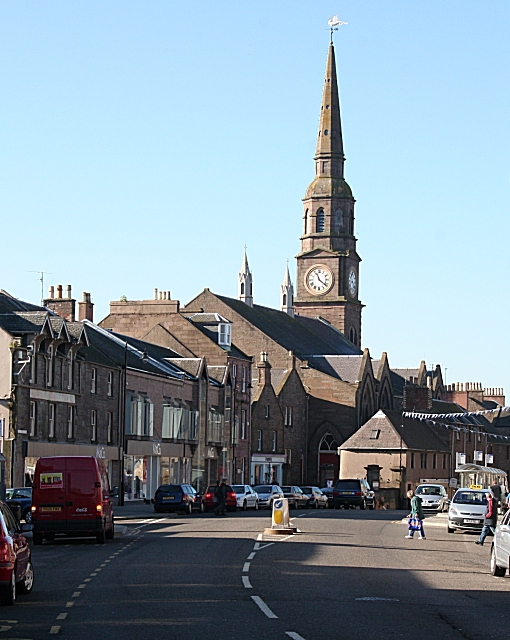
Image: © Anne Burgess Taken: 2 Oct 2007
This is almost the classic view of Forfar, with the steeple of the parish kirk rising above the curve of East High Street. Note two houses built in mediaeval style with gable ends facing the street.
Images are licensed for reuse under creativecommons.org/licenses/by-sa/2.0
Image Location
Latitude
56.643869
Longitude
-2.887342