St Michael's Church, Madeley
Introduction
The photograph on this page of St Michael's Church, Madeley by Richard Law as part of the Geograph project.
The Geograph project started in 2005 with the aim of publishing, organising and preserving representative images for every square kilometre of Great Britain, Ireland and the Isle of Man.

There are currently over 7.5m images from over 14,400 individuals and you can help contribute to the project by visiting https://www.geograph.org.uk
St Michael's Church, Madeley
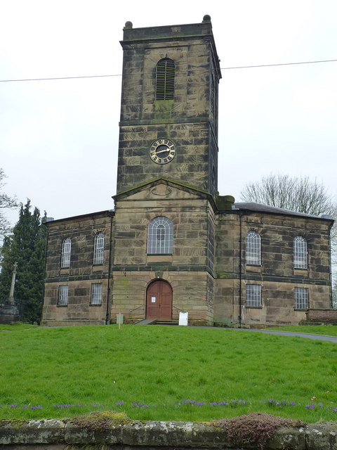
Image: © Richard Law Taken: 7 Apr 2018
Designed and built in 1976 by the then Surveyor of Public Works for Shropshire, one Thomas Telford, the church is now Grade II* listed https://www.britishlistedbuildings.co.uk/101293011-church-of-st-michael-madeley#.WuF1g_nwaM8 in 1983. There are several cast iron tombs of local industrialists in the graveyard.
Images are licensed for reuse under creativecommons.org/licenses/by-sa/2.0
Image Location
Latitude
52.633704
Longitude
-2.45032