
Ruined croft house, 5-6 Hacklet (Hacleit), in 1995
Introduction
The photograph on this page of Ruined croft house, 5-6 Hacklet (Hacleit), in 1995 by Richard Sutcliffe as part of the Geograph project.
The Geograph project started in 2005 with the aim of publishing, organising and preserving representative images for every square kilometre of Great Britain, Ireland and the Isle of Man.

There are currently over 7.5m images from over 14,400 individuals and you can help contribute to the project by visiting https://www.geograph.org.uk
Ruined croft house, 5-6 Hacklet (Hacleit), in 1995
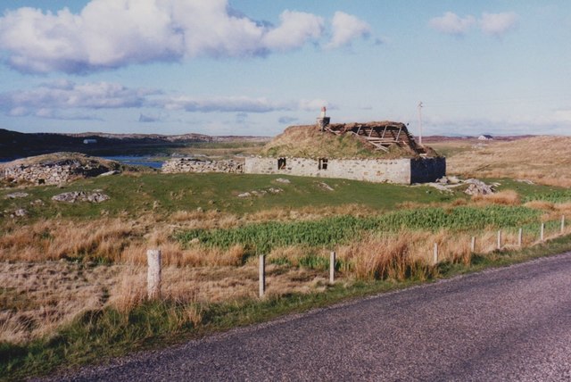
Image: © Richard Sutcliffe Taken: Unknown
Looking northeast across upper Loch Chearabhaigh (a sea loch) towards the scattered township of Kilerivagh. According to local information from Mary Harman in 2018, the house is still there with the mid gable with chimney standing, but the roof is entirely gone. The windows are still clear, and the winnowing hole in the barn at the left hand side of the picture is still there. The telegraph pole behind the house, being redundant is no longer there. The building probably dates from the 19th century and is Category B listed [http://portal.historicenvironment.scot/designation/LB18754]. It also appears on the Buildings at Risk Register [https://www.buildingsatrisk.org.uk/search/keyword/hacklet/event_id/898243/building_name/5-6-hacklet].
Images are licensed for reuse under creativecommons.org/licenses/by-sa/2.0
Image Location

Latitude
57.411892
Longitude
-7.304372