St Austell viaduct
Introduction
The photograph on this page of St Austell viaduct by Jonathan Billinger as part of the Geograph project.
The Geograph project started in 2005 with the aim of publishing, organising and preserving representative images for every square kilometre of Great Britain, Ireland and the Isle of Man.

There are currently over 7.5m images from over 14,400 individuals and you can help contribute to the project by visiting https://www.geograph.org.uk
St Austell viaduct
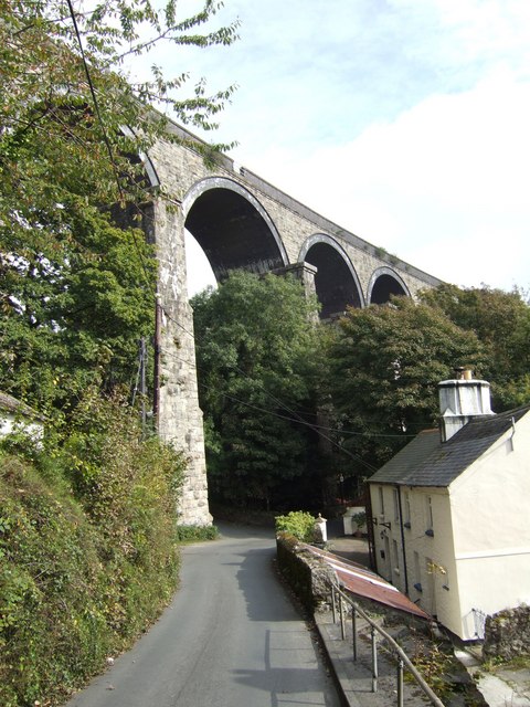
Image: © Jonathan Billinger Taken: 3 Oct 2007
The Penzance line crosses the Trenance valley to the west of St Austell town centre. It is 115 feet high, 720 feet long, and has 10 piers. The original viaducts built by I K Brunel on this line were wooden viaducts built on top of stone piers for speed and cheapness. On rebuilding, most of the new all-stone viaducts were built on a slightly different alignment to allow trains to continue running, the line being switched to the new alignment on completion of the new viaduct. The timber works of the old viaducts were then removed, leaving the stone piers still standing. Three of these old piers are visible in the photo (the third almost completely hidden by greenery). The cottages don't really lean in Cornwall!
Images are licensed for reuse under creativecommons.org/licenses/by-sa/2.0
Image Location


Leaflet Map data © OpenStreetMap
Latitude
50.342644
Longitude
-4.799536