
Bat gantry spanning the NDR
Introduction
The photograph on this page of Bat gantry spanning the NDR by Evelyn Simak as part of the Geograph project.
The Geograph project started in 2005 with the aim of publishing, organising and preserving representative images for every square kilometre of Great Britain, Ireland and the Isle of Man.

There are currently over 7.5m images from over 14,400 individuals and you can help contribute to the project by visiting https://www.geograph.org.uk
Bat gantry spanning the NDR
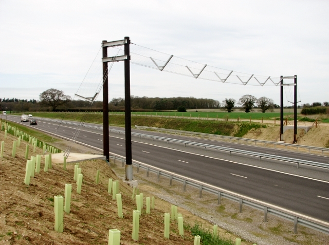
Image: © Evelyn Simak Taken: 17 Apr 2018
There are several along the route the NDR at strategical locations and one can only hope that the bats know what it is for. This one marks the location where a farm track > http://www.geograph.org.uk/photo/5045382 once used to give access into fields further to the north. This track is now cut off. Update: By October 2019, previously identified roosts of barbastelle bats, one of the rarest bat species in the UK seem to have disappeared in the vicinity of Felthorpe and Rackheath, with attempts to trap bats in those areas failing to land any female barbastelles and only one male specimen. Opponents of the mooted Northern Distributor Road Western Link had previously criticised the council for deciding a preferred route before bat surveys in the area were complete. The owner of a wood located on the proposed route had a Freedom Of Information request to Norfolk County Council for details of those surveys refused. (EDP, 18 October 2019)
Images are licensed for reuse under creativecommons.org/licenses/by-sa/2.0
Image Location

Latitude
52.678263
Longitude
1.344272