Reigate Town Hall
Introduction
The photograph on this page of Reigate Town Hall by Ian Capper as part of the Geograph project.
The Geograph project started in 2005 with the aim of publishing, organising and preserving representative images for every square kilometre of Great Britain, Ireland and the Isle of Man.

There are currently over 7.5m images from over 14,400 individuals and you can help contribute to the project by visiting https://www.geograph.org.uk
Reigate Town Hall
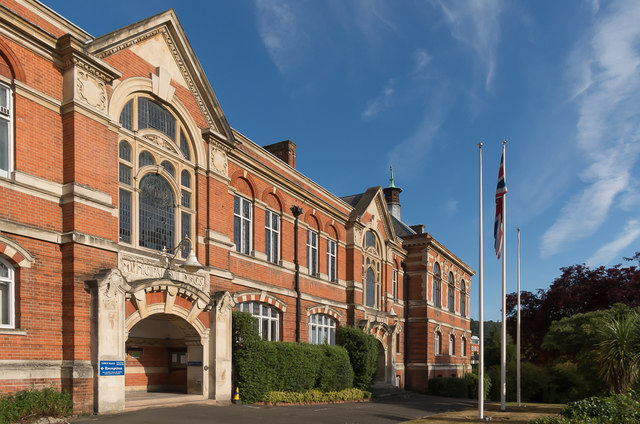
Image: © Ian Capper Taken: 3 Aug 2014
The offices of Reigate and Banstead Borough Council in Castlefield Road, dating from 1901. The building was designed by the architects Hugh Macintosh and Reginald Newman. It was originally known as the Municipal Buildings, housing the Town Hall (which was in the nearest section of the building in this photo), the police station and court house (at the far end) and fire station (off the left of this photo - see Image). The police station is now in Reigate Road (see Image), having first moved to Cherchefelle (see Image) then, the courts are now in Hatchlands Road (see Image) and the fire station in Croydon Road (see Image), leaving the local council, now expanded from the original Borough of Reigate, as the sole occupant since 1974. The building is grade II listed - see www.historicengland.org.uk/listing/the-list/list-entry/1260489.
Images are licensed for reuse under creativecommons.org/licenses/by-sa/2.0
Image Location
Latitude
51.239438
Longitude
-0.204955