Tadcaster Cemetery
Introduction
The photograph on this page of Tadcaster Cemetery by Paul Glazzard as part of the Geograph project.
The Geograph project started in 2005 with the aim of publishing, organising and preserving representative images for every square kilometre of Great Britain, Ireland and the Isle of Man.

There are currently over 7.5m images from over 14,400 individuals and you can help contribute to the project by visiting https://www.geograph.org.uk
Tadcaster Cemetery
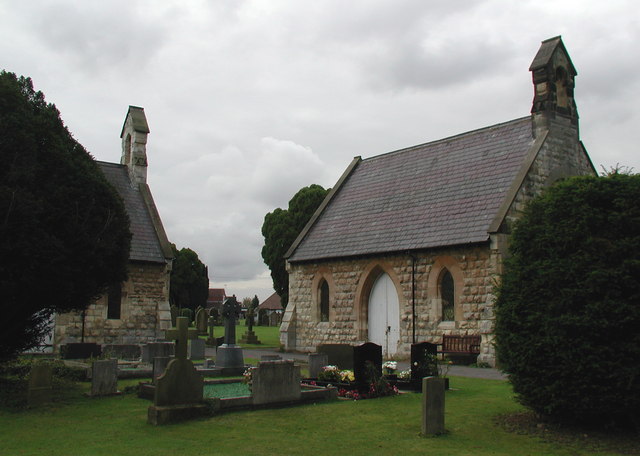
Image: © Paul Glazzard Taken: 2 Oct 2007
The twin chapels of rest at Tadcaster Cemetery, a 6½ acre site on the south side of Leeds Road which was laid out by the town's Burial Board formed in 1875, and was originally divided into three separate plots for 'churchmen, nonconformists and catholics'.
Images are licensed for reuse under creativecommons.org/licenses/by-sa/2.0
Image Location


Leaflet Map data © OpenStreetMap
Latitude
53.880451
Longitude
-1.272841