Nether Hall, Scraptoft
Introduction
The photograph on this page of Nether Hall, Scraptoft by Alan Murray-Rust as part of the Geograph project.
The Geograph project started in 2005 with the aim of publishing, organising and preserving representative images for every square kilometre of Great Britain, Ireland and the Isle of Man.

There are currently over 7.5m images from over 14,400 individuals and you can help contribute to the project by visiting https://www.geograph.org.uk
Nether Hall, Scraptoft
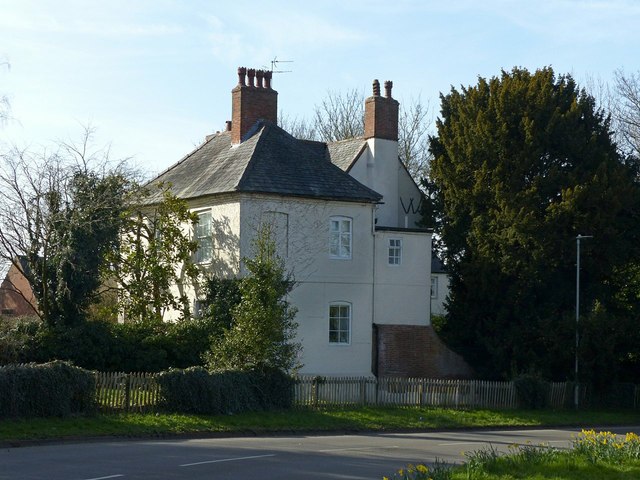
Image: © Alan Murray-Rust Taken: 5 Apr 2018
The 'W' just visible on the right hand gable is an initial which originally accompanied a date, 1709, partly lost to extensions to the building. Listed Grade II. The hall gives its name to a large council estate of Leicester City Council.
Images are licensed for reuse under creativecommons.org/licenses/by-sa/2.0
Image Location
Latitude
52.646028
Longitude
-1.048866