St Matthew's Church, Treorchy
Introduction
The photograph on this page of St Matthew's Church, Treorchy by Jaggery as part of the Geograph project.
The Geograph project started in 2005 with the aim of publishing, organising and preserving representative images for every square kilometre of Great Britain, Ireland and the Isle of Man.

There are currently over 7.5m images from over 14,400 individuals and you can help contribute to the project by visiting https://www.geograph.org.uk
St Matthew's Church, Treorchy
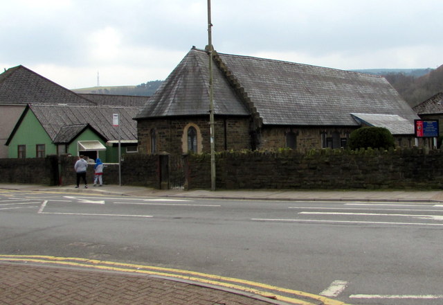
Image: © Jaggery Taken: 9 Apr 2018
Located on the corner of Bute Street and Cardiff Street, St Matthew's is in the Church in Wales Diocese of Llandaff. https://www.geograph.org.uk/photo/5733413 to the information board on the right. Coflein records that the building was erected in 1871 as a National School. It is shown on the first edition Ordnance Survey 25" map as School (Boys and Girls). By 1900 it is annotated Church, by which time the rectangular building had the addition of an apse. The corrugated iron hall on the left dates from the early 20th century.
Images are licensed for reuse under creativecommons.org/licenses/by-sa/2.0
Image Location
Latitude
51.661966
Longitude
-3.510508