Unity Street, Bristol
Introduction
The photograph on this page of Unity Street, Bristol by Derek Harper as part of the Geograph project.
The Geograph project started in 2005 with the aim of publishing, organising and preserving representative images for every square kilometre of Great Britain, Ireland and the Isle of Man.

There are currently over 7.5m images from over 14,400 individuals and you can help contribute to the project by visiting https://www.geograph.org.uk
Unity Street, Bristol
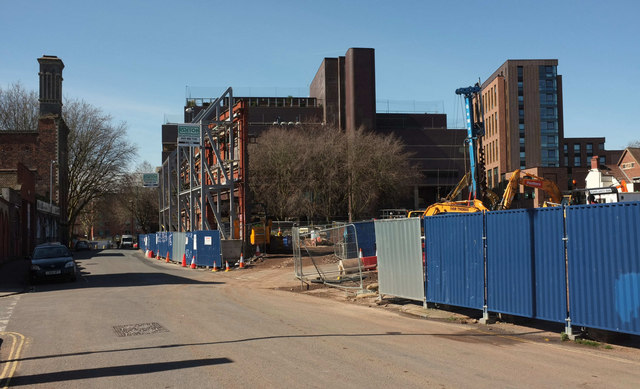
Image: © Derek Harper Taken: 5 Apr 2018
On the immediate left is New Thomas Street, followed by Gardiner's Warehouse - see Image Left of centre are Image], with One Temple Way beyond (architect:John Collins). Behind the pile driver is The Print Hall, recently-built student accommodation by Russ Drage Architects http://heynetillettsteel.com/projects/the-print-hall-bristol .
Images are licensed for reuse under creativecommons.org/licenses/by-sa/2.0
Image Location
Latitude
51.454807
Longitude
-2.581243