The Wirral Way
Introduction
The photograph on this page of The Wirral Way by Stephen McKay as part of the Geograph project.
The Geograph project started in 2005 with the aim of publishing, organising and preserving representative images for every square kilometre of Great Britain, Ireland and the Isle of Man.

There are currently over 7.5m images from over 14,400 individuals and you can help contribute to the project by visiting https://www.geograph.org.uk
The Wirral Way
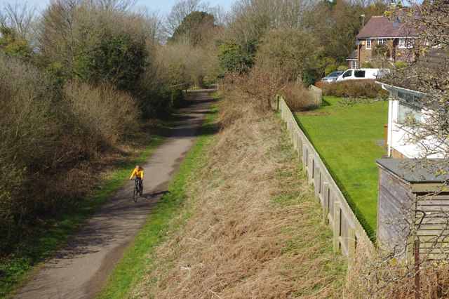
Image: © Stephen McKay Taken: 5 Apr 2018
A cyclist approaches the Delavor Road bridge along the route of the West Kirby - Hooton railway; trains last passed along here in 1962. It is now the Wirral Way.
Images are licensed for reuse under creativecommons.org/licenses/by-sa/2.0
Image Location
Latitude
53.326545
Longitude
-3.115514