Old Watchtower in Ten Acre Wood
Introduction
The photograph on this page of Old Watchtower in Ten Acre Wood by Des Blenkinsopp as part of the Geograph project.
The Geograph project started in 2005 with the aim of publishing, organising and preserving representative images for every square kilometre of Great Britain, Ireland and the Isle of Man.

There are currently over 7.5m images from over 14,400 individuals and you can help contribute to the project by visiting https://www.geograph.org.uk
Old Watchtower in Ten Acre Wood
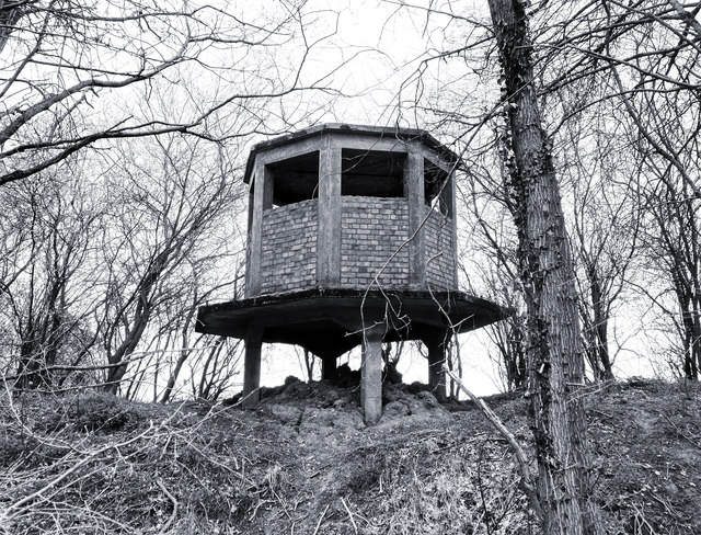
Image: © Des Blenkinsopp Taken: 7 Apr 2018
A remnant of the old WW2 airfield at Shepherds Grove which operated 1943 - 1966. One or two old military buildings are nearby and the roads and runways have become farm tracks.
Images are licensed for reuse under creativecommons.org/licenses/by-sa/2.0
Image Location
Latitude
52.311102
Longitude
0.921935