
Second sign of danger
Introduction
The photograph on this page of Second sign of danger by Graham Horn as part of the Geograph project.
The Geograph project started in 2005 with the aim of publishing, organising and preserving representative images for every square kilometre of Great Britain, Ireland and the Isle of Man.

There are currently over 7.5m images from over 14,400 individuals and you can help contribute to the project by visiting https://www.geograph.org.uk
Second sign of danger
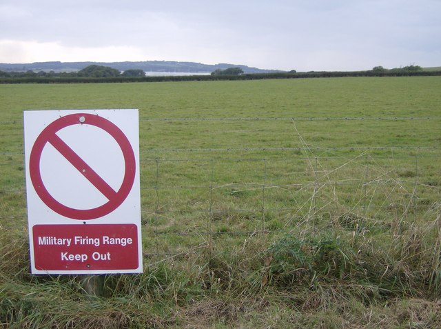
Image: © Graham Horn Taken: 29 Sep 2007
The footpath to the beach passes through a military firing range, and signs like this abound. Actually they appear only on the west side of the path, although the maps show the danger area extending to the east as well. It appears that the official area, set out in bylaws dated 1915 and confirmed in 1935, covers a wider area than is currently designated. Looking west, the area extends to Clamerkin Lake and Newtown River seen in the middle distance. The land is primarily grazing land.
Images are licensed for reuse under creativecommons.org/licenses/by-sa/2.0
Image Location

Latitude
50.723957
Longitude
-1.37292