Tangley Place Farm
Introduction
The photograph on this page of Tangley Place Farm by Ron Strutt as part of the Geograph project.
The Geograph project started in 2005 with the aim of publishing, organising and preserving representative images for every square kilometre of Great Britain, Ireland and the Isle of Man.

There are currently over 7.5m images from over 14,400 individuals and you can help contribute to the project by visiting https://www.geograph.org.uk
Tangley Place Farm
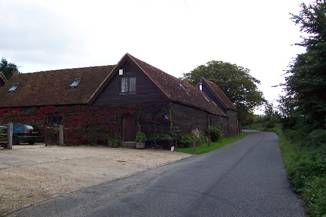
Image: © Ron Strutt Taken: 24 Sep 2005
Tangley Place Farm is just beyond the built-up fringe of Guildford but only just! It looks out over open fields but less than half a kilometre away is wall to wall housing. Most of the surrounding fields are now used for keeping horses.
Images are licensed for reuse under creativecommons.org/licenses/by-sa/2.0
Image Location


Leaflet Map data © OpenStreetMap
Latitude
51.265111
Longitude
-0.602492