111-112 Corve Street
Introduction
The photograph on this page of 111-112 Corve Street by Ian Capper as part of the Geograph project.
The Geograph project started in 2005 with the aim of publishing, organising and preserving representative images for every square kilometre of Great Britain, Ireland and the Isle of Man.

There are currently over 7.5m images from over 14,400 individuals and you can help contribute to the project by visiting https://www.geograph.org.uk
111-112 Corve Street
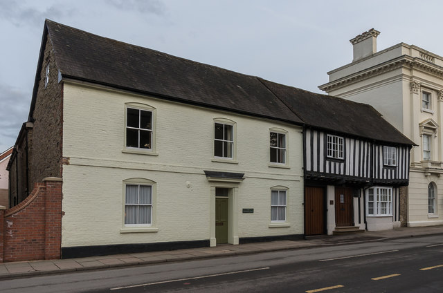
Image: © Ian Capper Taken: 16 Feb 2018
Pair of buildings on Corve Street, both grade II listed. On the left is no 111 - 18th century with earlier origins - see www.historicengland.org.uk/listing/the-list/list-entry/1290614 and on the right is no 112 (the half timbered building), 16th century with later additions, see www.historicengland.org.uk/listing/the-list/list-entry/1221213.
Images are licensed for reuse under creativecommons.org/licenses/by-sa/2.0
Image Location
Latitude
52.37186
Longitude
-2.719267