Stone House
Introduction
The photograph on this page of Stone House by Ian Capper as part of the Geograph project.
The Geograph project started in 2005 with the aim of publishing, organising and preserving representative images for every square kilometre of Great Britain, Ireland and the Isle of Man.

There are currently over 7.5m images from over 14,400 individuals and you can help contribute to the project by visiting https://www.geograph.org.uk
Stone House
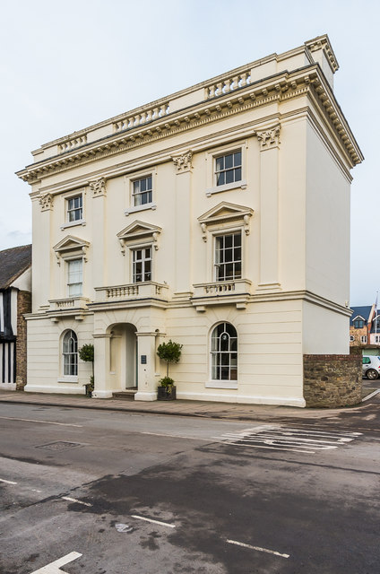
Image: © Ian Capper Taken: 16 Feb 2018
Former offices of South Shropshire District Council, until the council was abolished in 2009 with the area becoming the responsibility of the new Shropshire unitary authority. It was converted to residential use in 2011. It was originally built in the 18th century, and the stucco front was added in around 1840 (obscuring not just the front but also the relevance of the building's name!). It is grade II* listed - see www.historicengland.org.uk/listing/the-list/list-entry/1281966.
Images are licensed for reuse under creativecommons.org/licenses/by-sa/2.0
Image Location
Latitude
52.371654
Longitude
-2.719219