Tolbooth, Crail
Introduction
The photograph on this page of Tolbooth, Crail by G Laird as part of the Geograph project.
The Geograph project started in 2005 with the aim of publishing, organising and preserving representative images for every square kilometre of Great Britain, Ireland and the Isle of Man.

There are currently over 7.5m images from over 14,400 individuals and you can help contribute to the project by visiting https://www.geograph.org.uk
Tolbooth, Crail
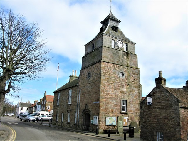
Image: © G Laird Taken: 29 Mar 2018
The lower part of the rubble masonry tollbooth dates from the 16th century, possibly 1517 or 1598. The upper stages and slated pagoda-like belfry date from 1776. The tollbooth is prominently located in the Centre of Crail and is a Category A listed building. https://www.britishlistedbuildings.co.uk/200359021-the-tolbooth-and-town-hall-marketgate-crail#.Wr5OjjGWytU
Images are licensed for reuse under creativecommons.org/licenses/by-sa/2.0
Image Location
Latitude
56.260843
Longitude
-2.626143