Public footpath south of Madeley Heath
Introduction
The photograph on this page of Public footpath south of Madeley Heath by Jonathan Hutchins as part of the Geograph project.
The Geograph project started in 2005 with the aim of publishing, organising and preserving representative images for every square kilometre of Great Britain, Ireland and the Isle of Man.

There are currently over 7.5m images from over 14,400 individuals and you can help contribute to the project by visiting https://www.geograph.org.uk
Public footpath south of Madeley Heath
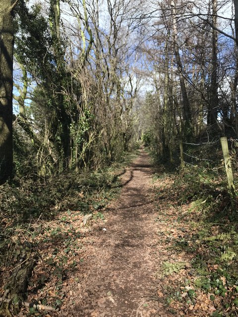
Image: © Jonathan Hutchins Taken: 25 Mar 2018
This footpath runs along the trackbed of Thomas Firmstone's railway. He was a local industrialist who constructed his own three and a half mile railway from his leased mines at Leycett through Madeley Heath to the main line station at Madeley in 1838. On the right is the tile factory site of Marley Eternit https://www.geograph.org.uk/photo/5717690
Images are licensed for reuse under creativecommons.org/licenses/by-sa/2.0
Image Location
Latitude
53.004673
Longitude
-2.320501