Western boundary wall of the Flagstaff View Point site
Introduction
The photograph on this page of Western boundary wall of the Flagstaff View Point site by Eric Jones as part of the Geograph project.
The Geograph project started in 2005 with the aim of publishing, organising and preserving representative images for every square kilometre of Great Britain, Ireland and the Isle of Man.

There are currently over 7.5m images from over 14,400 individuals and you can help contribute to the project by visiting https://www.geograph.org.uk
Western boundary wall of the Flagstaff View Point site
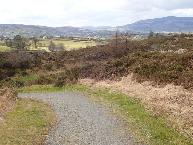
Image: © Eric Jones Taken: 13 Mar 2018
This WSW view shows a large section of the Gullion caldera. Slieve Gullion. the largest of the upland blocks in the background of the image is the remains of the original volcano. Parts of the south-eastern section of the Gullion Ring Dyke occupies much of the background on the left and, seen between the Cooley Mountains and Slieve Gullion, are the south-western hills of the Ring Dyke, including Croslieve and Tievecrom in the Forkill area.
Images are licensed for reuse under creativecommons.org/licenses/by-sa/2.0
Image Location
Latitude
54.117938
Longitude
-6.31485