Flush Bracket, Annalong
Introduction
The photograph on this page of Flush Bracket, Annalong by Rossographer as part of the Geograph project.
The Geograph project started in 2005 with the aim of publishing, organising and preserving representative images for every square kilometre of Great Britain, Ireland and the Isle of Man.

There are currently over 7.5m images from over 14,400 individuals and you can help contribute to the project by visiting https://www.geograph.org.uk
Flush Bracket, Annalong
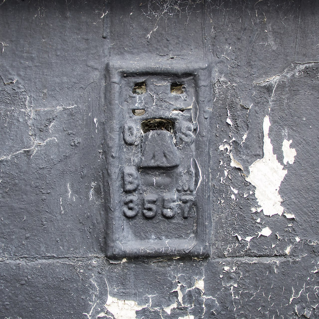
Image: © Rossographer Taken: 25 Mar 2018
Flush bracket bench mark on the southern side of a house on the corner of main Street and the A2 Glasdrumman Road in Annalong Image The number on the bracket is OSBM 3557. The mark has been levelled to 17.92 metres above MSL.
Images are licensed for reuse under creativecommons.org/licenses/by-sa/2.0
Image Location
Latitude
54.108227
Longitude
-5.90033