The King William IV in Nuneaton, Warwickshire
Introduction
The photograph on this page of The King William IV in Nuneaton, Warwickshire by Roger D Kidd as part of the Geograph project.
The Geograph project started in 2005 with the aim of publishing, organising and preserving representative images for every square kilometre of Great Britain, Ireland and the Isle of Man.

There are currently over 7.5m images from over 14,400 individuals and you can help contribute to the project by visiting https://www.geograph.org.uk
The King William IV in Nuneaton, Warwickshire
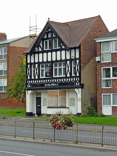
Image: © Roger D Kidd Taken: 19 Aug 2013
Shown here in 2013 (closed in 2012), the King William IV was set on fire by arsonists in 2015, had planning refused for conversion into six flats, and a further application in 2016 for a five flat conversion does not appear to have progressed according to a 2017 image on Geograph: http://www.geograph.org.uk/photo/5313229
Images are licensed for reuse under creativecommons.org/licenses/by-sa/2.0
Image Location
Latitude
52.516855
Longitude
-1.46738