Frenchay Bridge
Introduction
The photograph on this page of Frenchay Bridge by Mike Faherty as part of the Geograph project.
The Geograph project started in 2005 with the aim of publishing, organising and preserving representative images for every square kilometre of Great Britain, Ireland and the Isle of Man.

There are currently over 7.5m images from over 14,400 individuals and you can help contribute to the project by visiting https://www.geograph.org.uk
Frenchay Bridge
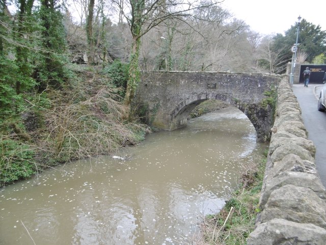
Image: © Mike Faherty Taken: 17 Mar 2018
Carrying Frenchay Hill / Frenchay Road over River Frome. There is a plaque dating the bridge to 1788; also bollards preventing vehicles. The bridge is listed by Historic England (Grade II): https://historicengland.org.uk/listing/the-list/list-entry/1276727
Images are licensed for reuse under creativecommons.org/licenses/by-sa/2.0
Image Location
Latitude
51.49277
Longitude
-2.519933