Dore Church
Introduction
The photograph on this page of Dore Church by Stephen McKay as part of the Geograph project.
The Geograph project started in 2005 with the aim of publishing, organising and preserving representative images for every square kilometre of Great Britain, Ireland and the Isle of Man.

There are currently over 7.5m images from over 14,400 individuals and you can help contribute to the project by visiting https://www.geograph.org.uk
Dore Church
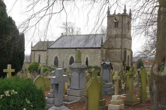
Image: © Stephen McKay Taken: 14 Mar 2018
There are some substantial headstones here perhaps indicative of the fact that Dore has long been an affluent area. Elsewhere in the churchyard smaller stones mark the graves of railway navvies and their families who died of smallpox while digging Totley Tunnel. Christ Church itself dates from 1828 and was designed by Richard Furniss (or Furness) a local schoolmaster, initially as a chapel of ease to Dronfield. Dore became a parish in its own right in 1844.
Images are licensed for reuse under creativecommons.org/licenses/by-sa/2.0
Image Location
Latitude
53.325662
Longitude
-1.539642