Collier House
Introduction
The photograph on this page of Collier House by Gerald England as part of the Geograph project.
The Geograph project started in 2005 with the aim of publishing, organising and preserving representative images for every square kilometre of Great Britain, Ireland and the Isle of Man.

There are currently over 7.5m images from over 14,400 individuals and you can help contribute to the project by visiting https://www.geograph.org.uk
Collier House
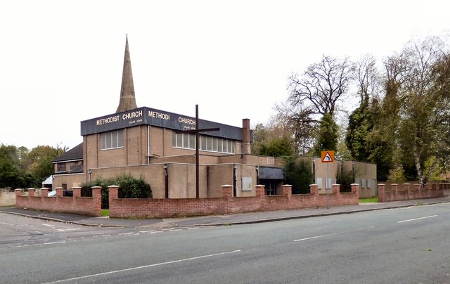
Image: © Gerald England Taken: 21 Oct 2017
The former Wellington Street Methodist Church now belongs to St James Image whose tower is visible in the background. St James' Church is a local ecumenical partnership between The Church of England and the Methodist Church and forms part of the Gorton Team Ministry which also includes Emmanuel Church, West Gorton and St. Philip's Church, Gorton. Collier House is also home to the Oasis Centre https://www.manchestercommunitycentral.org/contacts/view/52466 a community outreach day centre.
Images are licensed for reuse under creativecommons.org/licenses/by-sa/2.0
Image Location
Latitude
53.464308
Longitude
-2.172427