The rooftops of Bethania
Introduction
The photograph on this page of The rooftops of Bethania by Eric Jones as part of the Geograph project.
The Geograph project started in 2005 with the aim of publishing, organising and preserving representative images for every square kilometre of Great Britain, Ireland and the Isle of Man.

There are currently over 7.5m images from over 14,400 individuals and you can help contribute to the project by visiting https://www.geograph.org.uk
The rooftops of Bethania
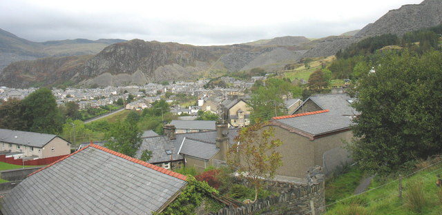
Image: © Eric Jones Taken: 28 Sep 2007
Bethania is one of the original group of discrete early nineteenth century village settlements which in time merged to form the town of Blaenau Ffestiniog. In the eighty years between 1801 and 1881, Blaena's population grew from 732 to 11,274. It has since declined to under 5,000. The early settlements however still retain their names and separate identity. Here, the local's loyalty is to Bethania first and Blaenau second. The same is true of the people of Manod, Congl-y-wal, Tan-y-grisiau etc. Some would argue that the name Blaenau Ffestiniog applies only to the commercial heart of the town.
Images are licensed for reuse under creativecommons.org/licenses/by-sa/2.0
Image Location


Leaflet Map data © OpenStreetMap
Latitude
52.988495
Longitude
-3.92706