The Ebenezer Erskine Monument
Introduction
The photograph on this page of The Ebenezer Erskine Monument by Lairich Rig as part of the Geograph project.
The Geograph project started in 2005 with the aim of publishing, organising and preserving representative images for every square kilometre of Great Britain, Ireland and the Isle of Man.

There are currently over 7.5m images from over 14,400 individuals and you can help contribute to the project by visiting https://www.geograph.org.uk
The Ebenezer Erskine Monument
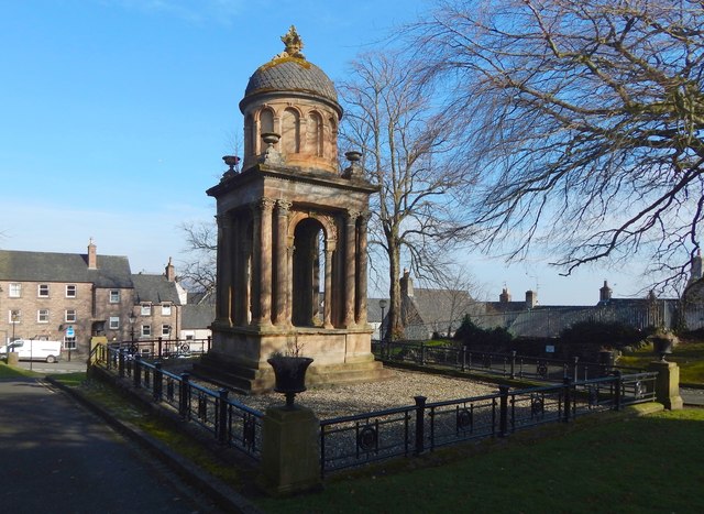
Image: © Lairich Rig Taken: 24 Feb 2018
The monument marks the site where Ebenezer Erskine was buried, which was, at that time, within a church: see http://portal.historicenvironment.scot/designation/LB41087 for details. After that church was demolished, the monument shown here (Peddie & Kinnear, 1859) was erected on the site of the tomb. The original church was replaced by another one nearby (Erskine Marykirk Church, behind the photographer's position); the facade of that church survives, and the modern extension behind it is now used as a youth hostel. Earlier pictures: Image / Image / Image Ebenezer Erskine is also commemorated by a statue in the Old Town Cemetery: Image
Images are licensed for reuse under creativecommons.org/licenses/by-sa/2.0
Image Location
Latitude
56.119919
Longitude
-3.943298