Former "Moulders Arms", Currock Street - March 2018
Introduction
The photograph on this page of Former "Moulders Arms", Currock Street - March 2018 by The Carlisle Kid as part of the Geograph project.
The Geograph project started in 2005 with the aim of publishing, organising and preserving representative images for every square kilometre of Great Britain, Ireland and the Isle of Man.

There are currently over 7.5m images from over 14,400 individuals and you can help contribute to the project by visiting https://www.geograph.org.uk
Former "Moulders Arms", Currock Street - March 2018
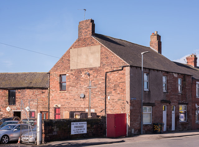
Image: © The Carlisle Kid Taken: 9 Mar 2018
A former pub which appears on no OS Map, the "Moulders Arms" probably dates from circa 1850. It was closed by the State Management Scheme on 20 September 1916 and has been a private house for the last 102 years. Apparently, until recent times, the name could still just be seen on the end wall.
Images are licensed for reuse under creativecommons.org/licenses/by-sa/2.0
Image Location
Latitude
54.887594
Longitude
-2.933277