Stamford Hall stage entrance
Introduction
The photograph on this page of Stamford Hall stage entrance by Richard Sutcliffe as part of the Geograph project.
The Geograph project started in 2005 with the aim of publishing, organising and preserving representative images for every square kilometre of Great Britain, Ireland and the Isle of Man.

There are currently over 7.5m images from over 14,400 individuals and you can help contribute to the project by visiting https://www.geograph.org.uk
Stamford Hall stage entrance
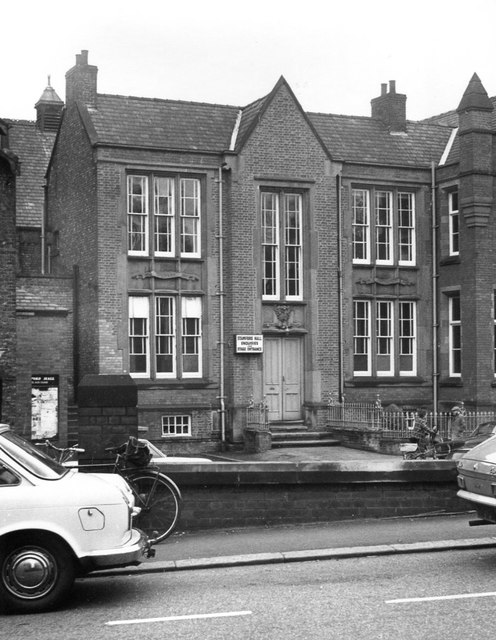
Image: © Richard Sutcliffe Taken: Unknown
Part of the library building on Lower George Street, Altrincham. The sign beside the door reads: 'STAMFORD HALL ENQUIRIES and STAGE ENTRANCE'. Up until 1923 the building housed a technical school. It was demolished in 1975.
Images are licensed for reuse under creativecommons.org/licenses/by-sa/2.0
Image Location


Leaflet Map data © OpenStreetMap
Latitude
53.38833
Longitude
-2.348788