Former "Petteril Bridge Inn" - February 2018 (1)
Introduction
The photograph on this page of Former "Petteril Bridge Inn" - February 2018 (1) by The Carlisle Kid as part of the Geograph project.
The Geograph project started in 2005 with the aim of publishing, organising and preserving representative images for every square kilometre of Great Britain, Ireland and the Isle of Man.

There are currently over 7.5m images from over 14,400 individuals and you can help contribute to the project by visiting https://www.geograph.org.uk
Former "Petteril Bridge Inn" - February 2018 (1)
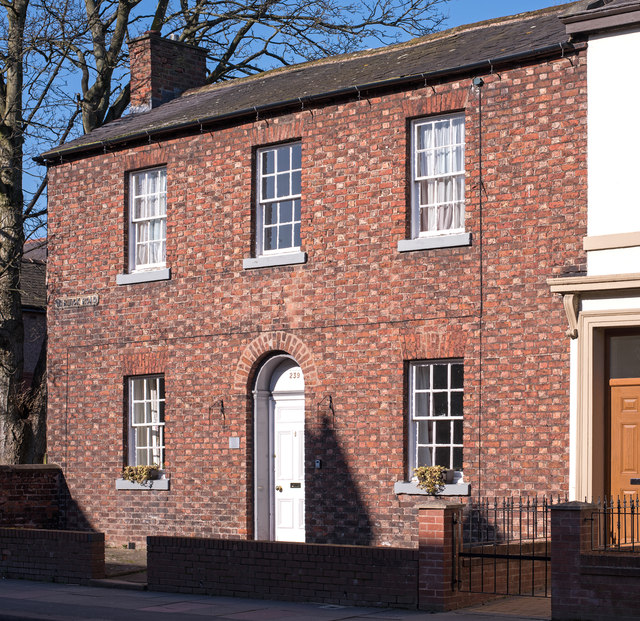
Image: © The Carlisle Kid Taken: 25 Feb 2018
The "Petteril Bridge Inn" appears on the 1865 OS Map, so is probably Victorian or late Georgian. It was acquired by the State Management Scheme on 30 August 1916, but is not mentioned on the 1925 OS Map, so may well have been closed in 1916 with business transferred to the nearby Bee Hive (see: Image] ). Now a private dwelling with no public access. See also: Image] .
Images are licensed for reuse under creativecommons.org/licenses/by-sa/2.0
Image Location
Latitude
54.894469
Longitude
-2.915505