St Margaret's Church, Burnage Lane
Introduction
The photograph on this page of St Margaret's Church, Burnage Lane by Gerald England as part of the Geograph project.
The Geograph project started in 2005 with the aim of publishing, organising and preserving representative images for every square kilometre of Great Britain, Ireland and the Isle of Man.

There are currently over 7.5m images from over 14,400 individuals and you can help contribute to the project by visiting https://www.geograph.org.uk
St Margaret's Church, Burnage Lane
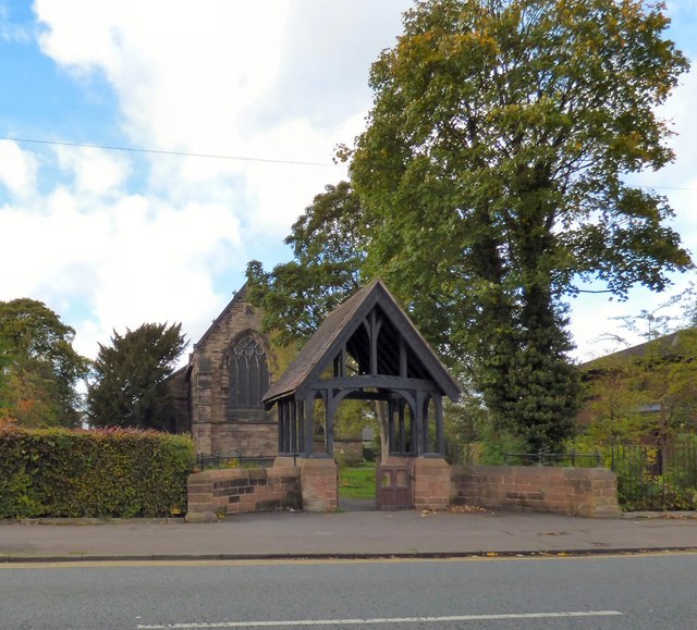
Image: © Gerald England Taken: 12 Oct 2017
The Grade II listed church https://historicengland.org.uk/listing/the-list/list-entry/1407271 opened in 1875. Construction took place in phases between 1874 and 1926. In 1919 a lych gate was erected as a war memorial https://www.iwm.org.uk/memorials/item/memorial/10719 to the parishioners killed during WWI, which was presented to the community by Alderman Lieut-Col T Turnbull. Church website: http://www.stmargaretsburnage.org.uk/
Images are licensed for reuse under creativecommons.org/licenses/by-sa/2.0
Image Location
Latitude
53.430826
Longitude
-2.201188