St Anne's R C Church, Pennywell
Introduction
The photograph on this page of St Anne's R C Church, Pennywell by Robert Graham as part of the Geograph project.
The Geograph project started in 2005 with the aim of publishing, organising and preserving representative images for every square kilometre of Great Britain, Ireland and the Isle of Man.

There are currently over 7.5m images from over 14,400 individuals and you can help contribute to the project by visiting https://www.geograph.org.uk
St Anne's R C Church, Pennywell
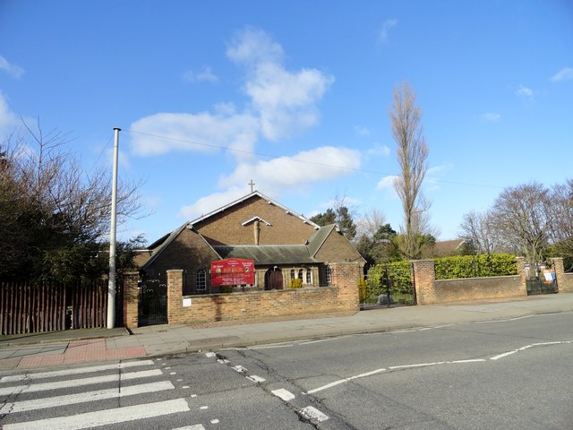
Image: © Robert Graham Taken: 20 Feb 2018
Pennywell was built as a large council housing estate on the western edge of Sunderland in the early 1950's. This church was built to serve the estate in 1957 to a modern design by Matkin and Hawkins of Sunderland.
Images are licensed for reuse under creativecommons.org/licenses/by-sa/2.0
Image Location
Latitude
54.900058
Longitude
-1.442655