World War 2. Defences
Introduction
The photograph on this page of World War 2. Defences by Peter Jeffery as part of the Geograph project.
The Geograph project started in 2005 with the aim of publishing, organising and preserving representative images for every square kilometre of Great Britain, Ireland and the Isle of Man.

There are currently over 7.5m images from over 14,400 individuals and you can help contribute to the project by visiting https://www.geograph.org.uk
World War 2. Defences
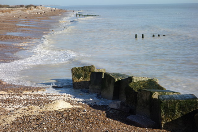
Image: © Peter Jeffery Taken: 17 Feb 2018
These large concrete blocks had, for many years stood at the top of a bank, backed by bushes. The storms of January 2018 washed away the bank and bushes and have left the blocks in the sea. The original shore line is indicated by the far groyne which used to end at the top of the beach. LinkImage
Images are licensed for reuse under creativecommons.org/licenses/by-sa/2.0
Image Location
Latitude
50.794623
Longitude
-0.588617