No 35, The Wharfage, Ironbridge
Introduction
The photograph on this page of No 35, The Wharfage, Ironbridge by Richard Law as part of the Geograph project.
The Geograph project started in 2005 with the aim of publishing, organising and preserving representative images for every square kilometre of Great Britain, Ireland and the Isle of Man.

There are currently over 7.5m images from over 14,400 individuals and you can help contribute to the project by visiting https://www.geograph.org.uk
No 35, The Wharfage, Ironbridge
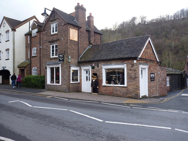
Image: © Richard Law Taken: 17 Feb 2018
For several years now the outlet for Merrythought Bears, 35 The Wharfage is a mid 19th century Grade II listed https://www.britishlistedbuildings.co.uk/101208037-35-the-wharfage-the-gorge#.Wo0kIfnFKM8 former house on the main road between Coalbrookdale and Ironbridge. It was listed in 1983, and included for group value with several nearby properties of similar age.
Images are licensed for reuse under creativecommons.org/licenses/by-sa/2.0
Image Location
Latitude
52.630024
Longitude
-2.493867