River Loxley, Hillsborough, Sheffield
Introduction
The photograph on this page of River Loxley, Hillsborough, Sheffield by David Hallam-Jones as part of the Geograph project.
The Geograph project started in 2005 with the aim of publishing, organising and preserving representative images for every square kilometre of Great Britain, Ireland and the Isle of Man.

There are currently over 7.5m images from over 14,400 individuals and you can help contribute to the project by visiting https://www.geograph.org.uk
River Loxley, Hillsborough, Sheffield
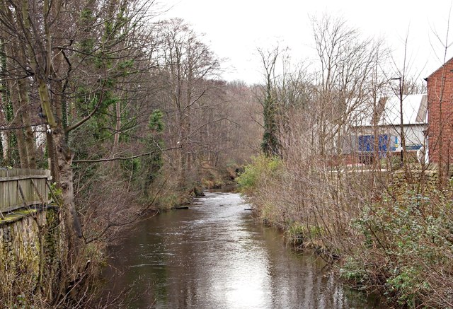
Image: © David Hallam-Jones Taken: 18 Feb 2018
A view towards Malin Bridge from the iron bridge that carries Walkley Lane across the River Loxley. The fencing on the left forms part of the boundary of "The Riverside" public house's terraced seating area. On the right, and on the other side of the industrial buildings, lies the A6101 (a.k.a Holme Lane) that links Hillsborough with Malin Bridge. "The Riverside" was known as “The Freemason's Arms” until 2013.
Images are licensed for reuse under creativecommons.org/licenses/by-sa/2.0
Image Location
Latitude
53.401912
Longitude
-1.501369