Walkley Lane, Hillsborough, Sheffield.
Introduction
The photograph on this page of Walkley Lane, Hillsborough, Sheffield. by David Hallam-Jones as part of the Geograph project.
The Geograph project started in 2005 with the aim of publishing, organising and preserving representative images for every square kilometre of Great Britain, Ireland and the Isle of Man.

There are currently over 7.5m images from over 14,400 individuals and you can help contribute to the project by visiting https://www.geograph.org.uk
Walkley Lane, Hillsborough, Sheffield.
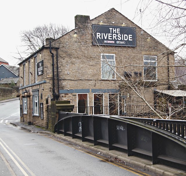
Image: © David Hallam-Jones Taken: 18 Feb 2018
Formerly a John Smith’s tied house during the 1980s “The Freemason's Arms” became “The Riverside” in 2013 because of its proximity to the River Loxley. This iron bridge, dating from the early C20th, was refurbished in 2014. The A6101 (a.k.a. Holme Lane) lies 10 metres or so behind the photographer.
Images are licensed for reuse under creativecommons.org/licenses/by-sa/2.0
Image Location
Latitude
53.401912
Longitude
-1.501369