Station Road, Dorking
Introduction
The photograph on this page of Station Road, Dorking by Stephen McKay as part of the Geograph project.
The Geograph project started in 2005 with the aim of publishing, organising and preserving representative images for every square kilometre of Great Britain, Ireland and the Isle of Man.

There are currently over 7.5m images from over 14,400 individuals and you can help contribute to the project by visiting https://www.geograph.org.uk
Station Road, Dorking
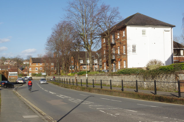
Image: © Stephen McKay Taken: 15 Feb 2018
Seen from its junction with Church Street, Station Road eventually leads to Dorking West station. Although previously known as Dorking Town, it is not nowadays an important stop - Dorking has two other better-served stations. The building on the right in this view is Franklin House, which was originally a Victorian candle factory. It later became offices but was converted in 2014 to six one-bedroomed flats.
Images are licensed for reuse under creativecommons.org/licenses/by-sa/2.0
Image Location
Latitude
51.232503
Longitude
-0.336918