Pishiobury Drive
Introduction
The photograph on this page of Pishiobury Drive by M J Richardson as part of the Geograph project.
The Geograph project started in 2005 with the aim of publishing, organising and preserving representative images for every square kilometre of Great Britain, Ireland and the Isle of Man.

There are currently over 7.5m images from over 14,400 individuals and you can help contribute to the project by visiting https://www.geograph.org.uk
Pishiobury Drive
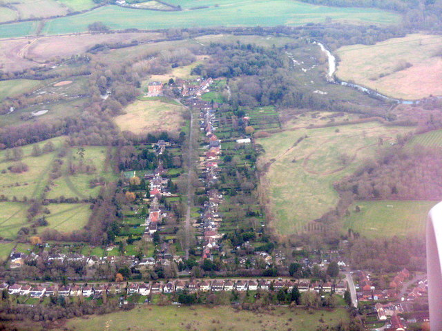
Image: © M J Richardson Taken: 6 Feb 2018
A private road leading to Pishiobury Park at Rowneybury. Leading southeast off the A1128 [Harlow Road], which runs across the lower part of the picture. The river is the Stort Navigation. https://en.wikipedia.org/wiki/Pishiobury , https://www.eastherts.gov.uk/article/35418/Pishiobury-Park .
Images are licensed for reuse under creativecommons.org/licenses/by-sa/2.0
Image Location
Latitude
51.802446
Longitude
0.135489