Beneath the Mancunian Way
Introduction
The photograph on this page of Beneath the Mancunian Way by Gerald England as part of the Geograph project.
The Geograph project started in 2005 with the aim of publishing, organising and preserving representative images for every square kilometre of Great Britain, Ireland and the Isle of Man.

There are currently over 7.5m images from over 14,400 individuals and you can help contribute to the project by visiting https://www.geograph.org.uk
Beneath the Mancunian Way
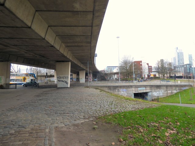
Image: © Gerald England Taken: 18 Feb 2017
The underside of the Mancunian Way, A57(M), crossing over the A34 Brook Street. In the background on the left is the "Road to Nowhere", an unfinished sliproad off the motorway which in ends in midair.
Images are licensed for reuse under creativecommons.org/licenses/by-sa/2.0
Image Location
Latitude
53.472111
Longitude
-2.235431