Former riverside warehouses in Worcester
Introduction
The photograph on this page of Former riverside warehouses in Worcester by Roger D Kidd as part of the Geograph project.
The Geograph project started in 2005 with the aim of publishing, organising and preserving representative images for every square kilometre of Great Britain, Ireland and the Isle of Man.

There are currently over 7.5m images from over 14,400 individuals and you can help contribute to the project by visiting https://www.geograph.org.uk
Former riverside warehouses in Worcester
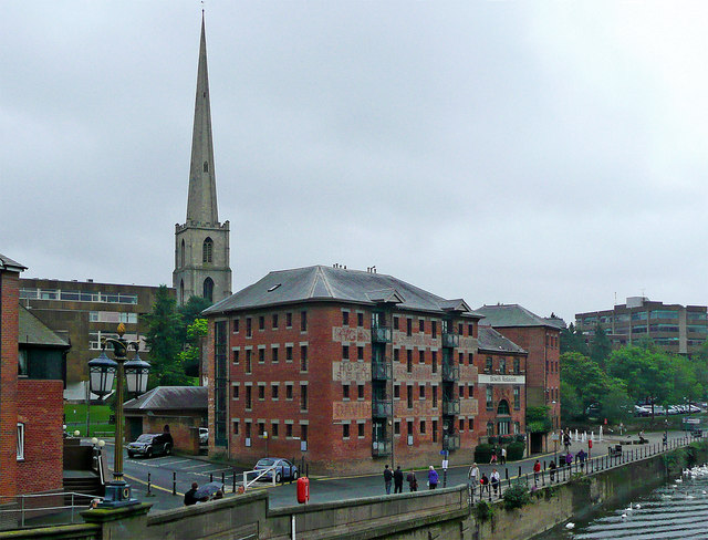
Image: © Roger D Kidd Taken: 21 Aug 2010
Seen by looking east from Worcester Bridge. The hop and seed warehouse has been converted to apartments. The spire is that of St Andrew's Church, which was demolished in 1947. The mediaeval tower, with its elegant spire of 1751, was preserved.
Images are licensed for reuse under creativecommons.org/licenses/by-sa/2.0
Image Location
Latitude
52.191047
Longitude
-2.224502