Mill Lane
Introduction
The photograph on this page of Mill Lane by Alan Walker as part of the Geograph project.
The Geograph project started in 2005 with the aim of publishing, organising and preserving representative images for every square kilometre of Great Britain, Ireland and the Isle of Man.

There are currently over 7.5m images from over 14,400 individuals and you can help contribute to the project by visiting https://www.geograph.org.uk
Mill Lane
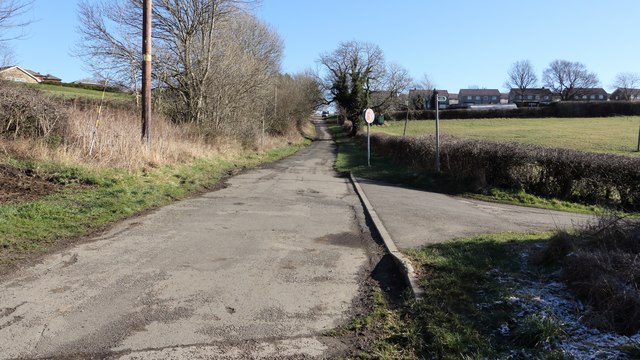
Image: © Alan Walker Taken: 7 Feb 2018
A walk around Grassmoor Image : Previous - (37 of 51) - Next : Image The photograph shows Mill Lane at its junction with the track, on the right, to Grange Farm. The start of this track also carries a public footpath leading to the western end of Gill's Lane. Ahead on the left, just a few metres after the telegraph pole, the same public footpath continues across fields to Westhill Lane, Avenue Farm and then on toward Hasland. Up the hill the road leads into Grassmoor. Just a few metres behind the viewpoint is a bridge that carries Mill Lane over the River Rother. See also this photograph by Alan Heardman:- Image
Images are licensed for reuse under creativecommons.org/licenses/by-sa/2.0
Image Location
Latitude
53.199029
Longitude
-1.402382