Cycle and walking route
Introduction
The photograph on this page of Cycle and walking route by Alan Walker as part of the Geograph project.
The Geograph project started in 2005 with the aim of publishing, organising and preserving representative images for every square kilometre of Great Britain, Ireland and the Isle of Man.

There are currently over 7.5m images from over 14,400 individuals and you can help contribute to the project by visiting https://www.geograph.org.uk
Cycle and walking route
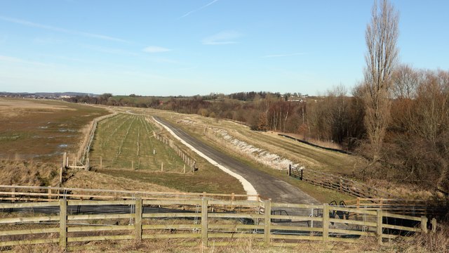
Image: © Alan Walker Taken: 7 Feb 2018
A walk around Grassmoor Image : Previous - (35 of 51) – Next : Image This photograph was taken from what is now the end of an embankment that once carried the trackbed of a branch line connecting the main line (behind the viewpoint) into the former Avenue Coking Works https://www.suez.com/en/our-offering/Success-stories/Our-references/Chesterfield-s-former-coking-works at Wingerworth. Before the works closed there was a bridge at this point that carried the trackbed over Mill Lane into the works and which still existed when this photograph by Nikki Mahadevan was taken:- Image The trail (yet to be opened in this photograph) parallels the course of the Midland main line, which is in the trees on the right, will eventually link with Storforth Lane in Chesterfield. In the immediate foreground is the approximate site of Wingerworth Mill after which Mill Lane was named. See also this photograph by Alan Murray-Rust:- Image
Images are licensed for reuse under creativecommons.org/licenses/by-sa/2.0
Image Location
Latitude
53.199597
Longitude
-1.408062