Keith's Pond
Introduction
The photograph on this page of Keith's Pond by Alan Walker as part of the Geograph project.
The Geograph project started in 2005 with the aim of publishing, organising and preserving representative images for every square kilometre of Great Britain, Ireland and the Isle of Man.

There are currently over 7.5m images from over 14,400 individuals and you can help contribute to the project by visiting https://www.geograph.org.uk
Keith's Pond
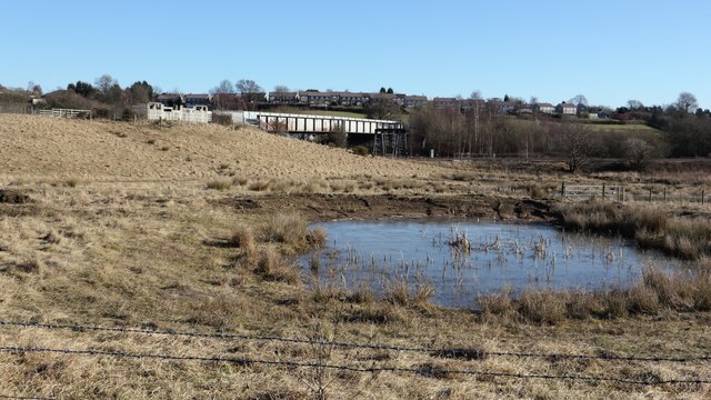
Image: © Alan Walker Taken: 7 Feb 2018
A walk around Grassmoor Image : Previous - (31 of 51) – Next : Image Taken from one of the viewpoints across the Avenue Washlands nature reserve http://www.derbyshirewildlifetrust.org.uk/reserves/the-avenue-washlands the photograph shows, in the foreground, Keith's Pond. Beyond this is a closed railway bridge over the Midland main line and beyond that the houses are on the western outskirts of Grassmoor. The OS map shows the bridge as the route of a cycle track running between Mill Lane (some 140m to the left) and Bridge Street in Tupton. This is not the case and the actual way has been diverted.
Images are licensed for reuse under creativecommons.org/licenses/by-sa/2.0
Image Location
Latitude
53.197795
Longitude
-1.407339