
Changes afoot in Fishguard/Abergwaun
Introduction
The photograph on this page of Changes afoot in Fishguard/Abergwaun by Natasha Ceridwen de Chroustchoff as part of the Geograph project.
The Geograph project started in 2005 with the aim of publishing, organising and preserving representative images for every square kilometre of Great Britain, Ireland and the Isle of Man.

There are currently over 7.5m images from over 14,400 individuals and you can help contribute to the project by visiting https://www.geograph.org.uk
Changes afoot in Fishguard/Abergwaun
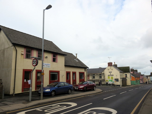
Image: © Natasha Ceridwen de Chroustchoff Taken: 7 Feb 2018
The building on the left, which has housed Transition Cafe (making use of surplus food) since 2013, is shortly to be demolished to make way for a new road that will provide a one-way system in Fishguard, relieving the bottleneck further down the High Street. The Ship and Anchor pub, empty and unfit for habitation, has been retained as deemed worthy of conservation. There are many within the community who feel that the decision about which building to demolish was misguided.
Images are licensed for reuse under creativecommons.org/licenses/by-sa/2.0
Image Location

Latitude
51.992549
Longitude
-4.979133