2007 : Railway Viaduct at Pitcombe
Introduction
The photograph on this page of 2007 : Railway Viaduct at Pitcombe by Maurice Pullin as part of the Geograph project.
The Geograph project started in 2005 with the aim of publishing, organising and preserving representative images for every square kilometre of Great Britain, Ireland and the Isle of Man.

There are currently over 7.5m images from over 14,400 individuals and you can help contribute to the project by visiting https://www.geograph.org.uk
2007 : Railway Viaduct at Pitcombe
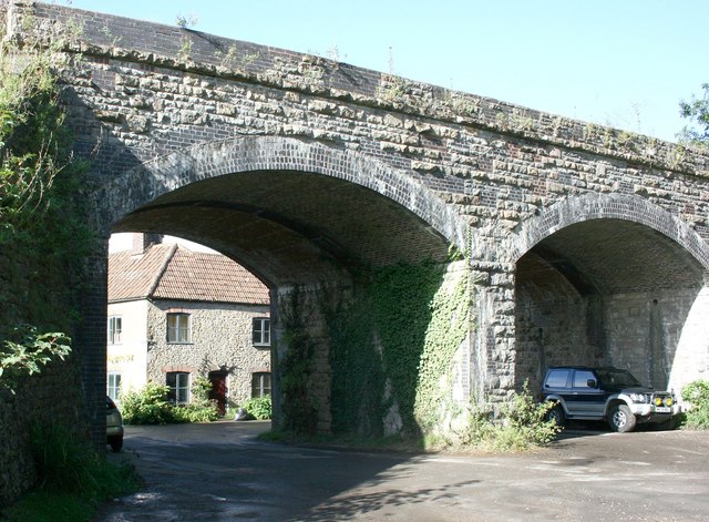
Image: © Maurice Pullin Taken: 25 Sep 2007
The railway over the viaduct has long been dismantled but the right hand arch has been recycled as a car port. This was the "slow and dirty", officially the Somerset & Dorset Railway. Cole Station was about half a mile north of here, Wincanton was the next stop south. For more see http://www.railscot.co.uk/Somerset_and_Dorset_Railway/frame.htm
Images are licensed for reuse under creativecommons.org/licenses/by-sa/2.0
Image Location
Latitude
51.096894
Longitude
-2.468923