Inverkip from Bargane Hill
Introduction
The photograph on this page of Inverkip from Bargane Hill by Thomas Nugent as part of the Geograph project.
The Geograph project started in 2005 with the aim of publishing, organising and preserving representative images for every square kilometre of Great Britain, Ireland and the Isle of Man.

There are currently over 7.5m images from over 14,400 individuals and you can help contribute to the project by visiting https://www.geograph.org.uk
Inverkip from Bargane Hill
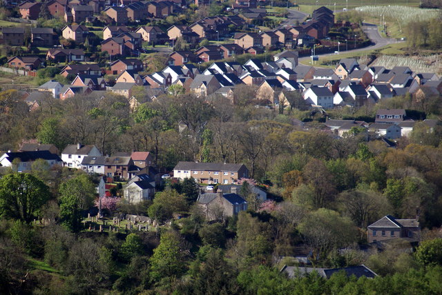
Image: © Thomas Nugent Taken: 29 Apr 2012
The old village and graveyard are in the foreground. The new houses in the background are at the Hill Farm estates. Note all the recently planted saplings in the top right corner.
Images are licensed for reuse under creativecommons.org/licenses/by-sa/2.0
Image Location
Latitude
55.909572
Longitude
-4.8626