Sea wall footpath looking south-west from Clacton-on-Sea
Introduction
The photograph on this page of Sea wall footpath looking south-west from Clacton-on-Sea by Duncan Graham as part of the Geograph project.
The Geograph project started in 2005 with the aim of publishing, organising and preserving representative images for every square kilometre of Great Britain, Ireland and the Isle of Man.

There are currently over 7.5m images from over 14,400 individuals and you can help contribute to the project by visiting https://www.geograph.org.uk
Sea wall footpath looking south-west from Clacton-on-Sea
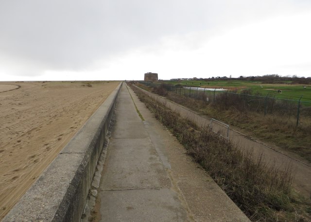
Image: © Duncan Graham Taken: 31 Jan 2018
This photograph was taken next to Burnham Court on the edge of Clacton's built-up area. On the left of the picture is the beach, on the right is the course of Clacton Golf Club (with the lake visible). In the centre is Martello Tower D (grade II listed, completed 1812), one of a series of small coastal forts built on the south and east coasts during the Napoleonic Wars. (The three Martello Towers between this one and Tower Road, Clacton, D to F, were all built between 1810 and 1812). On the horizon you can see housing in Jaywick. The Martello Tower is marked on Ordnance Survey maps.
Images are licensed for reuse under creativecommons.org/licenses/by-sa/2.0
Image Location
Latitude
51.777471
Longitude
1.133219