Bomb crater near Ashfield Farm
Introduction
The photograph on this page of Bomb crater near Ashfield Farm by Lairich Rig as part of the Geograph project.
The Geograph project started in 2005 with the aim of publishing, organising and preserving representative images for every square kilometre of Great Britain, Ireland and the Isle of Man.

There are currently over 7.5m images from over 14,400 individuals and you can help contribute to the project by visiting https://www.geograph.org.uk
Bomb crater near Ashfield Farm
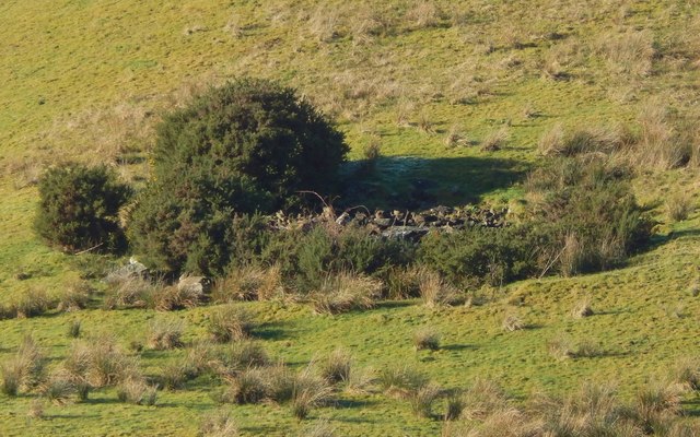
Image: © Lairich Rig Taken: 26 Jan 2018
First of all, my thanks to the farmer at Ashfield for kindly taking the time to point out the site to me, and for telling me more about the appearance of the crater itself. Like the context view linked below, this is a view from a distance (specifically, from beside the main road). The farmer was quite happy for me to make a follow-up visit to the crater itself later in the year, when the ground would be more suitable for walking on: see Image For a context view from a distance, see Image Click on the end-note title for other views, including those taken on the later visit. Although it is filled with stones, this feature does not have the appearance of an old quarry pit. A quarry in this very visible location would, despite its small size, have been sufficiently prominent to be marked on old OS maps. Later on the same day I did come across old quarries of similar or smaller size, in much more out-of-the-way places, that, as I later determined, were marked on those maps; see, for example, Image This crater seems to be isolated, not part of a group. The largest collection of bomb craters in the wider area is to be found about three miles to the SSE, on Dumbarton Muir: see https://www.geograph.org.uk/snippet/648
Images are licensed for reuse under creativecommons.org/licenses/by-sa/2.0
Image Location


Leaflet Map data © OpenStreetMap
Latitude
56.025151
Longitude
-4.561055