Leaving Balloch by the Stirling Road
Introduction
The photograph on this page of Leaving Balloch by the Stirling Road by Lairich Rig as part of the Geograph project.
The Geograph project started in 2005 with the aim of publishing, organising and preserving representative images for every square kilometre of Great Britain, Ireland and the Isle of Man.

There are currently over 7.5m images from over 14,400 individuals and you can help contribute to the project by visiting https://www.geograph.org.uk
Leaving Balloch by the Stirling Road
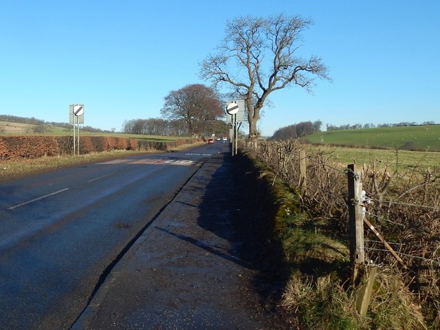
Image: © Lairich Rig Taken: 26 Jan 2018
A Image heads off to the photographer's right. That picture was taken from the same spot: note that the fence post at the far left in that view is on the right in this one. Current mapping shows a milestone somewhere ahead, but does not pinpoint its location. It is marked with greater precision on the second-edition map (1897): its position was beside the tall tree that can be seen not far ahead, to the right (east) of the road. It is no longer present (which is probably why modern mapping is a little vague about where it is); perhaps it was removed because it was viewed as cluttering the pavement, or it may be that it was hit by a vehicle leaving the road. The same comments apply to the milestone supposedly present almost opposite the start of the Image It was at about Image, on the east side of the road, a mile to the NNE of the spot where the present picture was taken. There is no pavement on that side of the road, but vehicles often travel too fast there, and one of them would have hit the milestone sooner or later.
Images are licensed for reuse under creativecommons.org/licenses/by-sa/2.0
Image Location
Latitude
56.008583
Longitude
-4.566857