Bosley St Mary's C of E Primary School
Introduction
The photograph on this page of Bosley St Mary's C of E Primary School by Alan Murray-Rust as part of the Geograph project.
The Geograph project started in 2005 with the aim of publishing, organising and preserving representative images for every square kilometre of Great Britain, Ireland and the Isle of Man.

There are currently over 7.5m images from over 14,400 individuals and you can help contribute to the project by visiting https://www.geograph.org.uk
Bosley St Mary's C of E Primary School
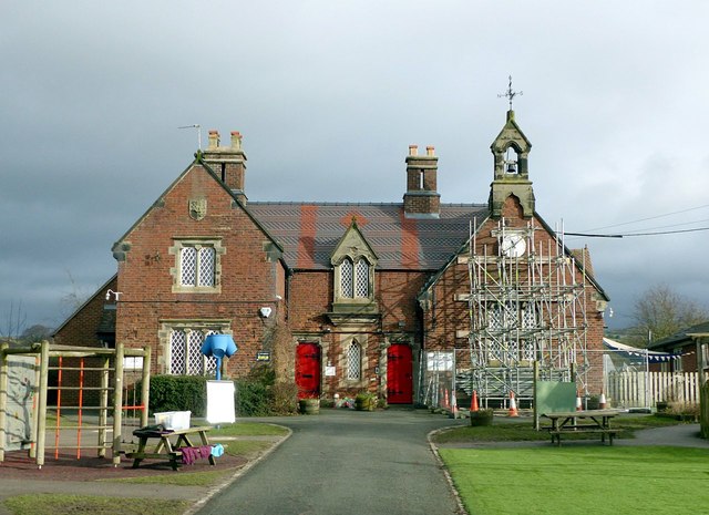
Image: © Alan Murray-Rust Taken: 25 Jan 2018
Built in 1858, incorporating the schoolmaster's house in the left hand portion and the schoolroom under the bell turret to the right. Features of the building include the cast-iron window frames with small diamond panes and the decorative tilework. Listed Grade II.
Images are licensed for reuse under creativecommons.org/licenses/by-sa/2.0
Image Location
Latitude
53.187968
Longitude
-2.123425