Fire-damaged United Reformed Church, High Street
Introduction
The photograph on this page of Fire-damaged United Reformed Church, High Street by John Baker as part of the Geograph project.
The Geograph project started in 2005 with the aim of publishing, organising and preserving representative images for every square kilometre of Great Britain, Ireland and the Isle of Man.

There are currently over 7.5m images from over 14,400 individuals and you can help contribute to the project by visiting https://www.geograph.org.uk
Fire-damaged United Reformed Church, High Street
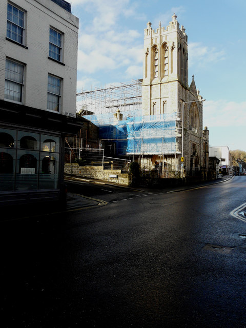
Image: © John Baker Taken: 5 Jan 2018
Planning permission has been registered by Dover District Council under application number DOV/18/01263 for the “conversion of church building to provide 16 self-contained apartments and associated development (amended plans)”. This is the latest in a series of planning applications due to there not being any parking spaces at the church; the only remedy would be for residents to use nearby roads, which could be unpopular for those people who live in them and own a car. This image of the Image shows the church, when the conversion work had just started.
Images are licensed for reuse under creativecommons.org/licenses/by-sa/2.0
Image Location


Leaflet Map data © OpenStreetMap
Latitude
51.128287
Longitude
1.307909